Thorpe Triangle Trust

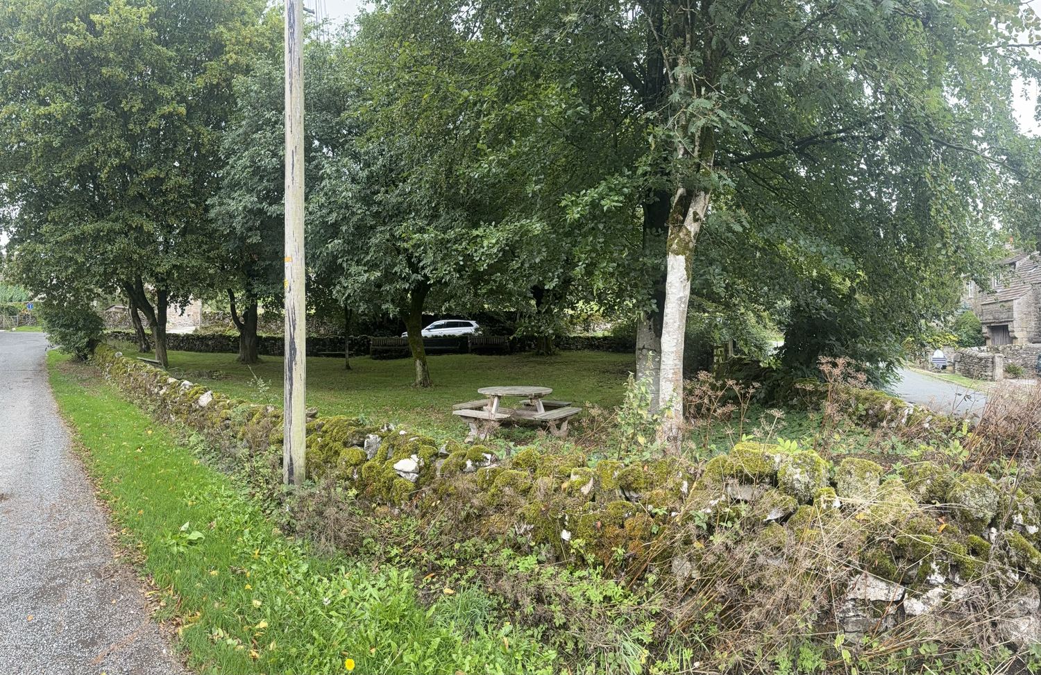
The triangle at Thorpe is cut, insured and looked after by the people who live here. Twenty-one households. No council, no funding, and no charge to sit on it.

If you've stopped here on your way between Linton and Burnsall, rested on a bench or eaten your lunch under the trees, this is who keeps it that way.

The Bull Agreement, 1622

In 1622 Sir Stephen Tempest, Lord of the Manor of Thorpe, leased several pieces of land in the village for six thousand years, at a rent of fourteen pence a year payable on St Martin's Day, to Henry Robinson and eighteen other men of Thorpe, for the keeping and maintaining of a common bull. Twenty-one names appear on the deed.

The agreement put Thorpe in the vanguard of agricultural improvement. Until then bulls and cows roamed the open land and bred haphazardly. By choosing a common bull with good characteristics to cover their cows, the farmers could be sure those characteristics were passed on. It was more than two hundred years later that Robert Bakewell, a Leicestershire tenant farmer, advocated what became known as selective breeding.

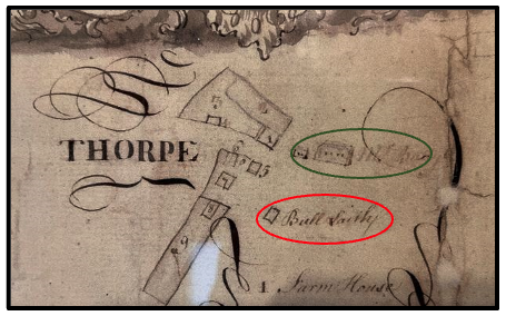
One of the pieces of land mentioned in the 1622 lease was known as Bulltaile, half a rood — 605 square yards. That is mostly what is now the triangle, and the Bull Laith on Kirshaw's plan is likely where the common bull was kept.
A northern longhorn, the type of bull common in Yorkshire in the seventeenth century.
The twenty-one men named in the Bull Agreement

Spelling as on the agreement.

Henry Robinson · William King, a bowman in the 1539 muster roll · Nicholas Rayner, who bought Thorpe Hall in 1608 · Richerd Richerdsonn · Thomas Baine, who bought Thorpe Hall from Nicholas Rayner; his initials are on the lintel of Steel's Laith · Nicholas Blagburne the younger, of Blackburn House · William Marton, possibly of Sandbeds · Henry Robinson, tenant at will · Anthony Tennante, who has a laith named after him · Thomas Rayner, possibly a relative of Nicholas · William Wrathall, of Manor House Cottage · George Bownebye, later written Bombie · William Bland · Robert Sim, a bowman in 1539 and a free tenant, later Sym · John Bolland, tenant at will, with a laith named after him · Thomas Hargraves · William Battie, free tenant, of the cottage that became the Manor House · John Westwoode · William Bearn, husbandman · James Prockter, tenant at will · Anthony Richerdsonn, son of Richard, tenant at will
The open space, 1768

The land at the centre of Thorpe has been the focal point of the village for centuries. The piece we call the triangle has gone by various names and served different purposes over the years.

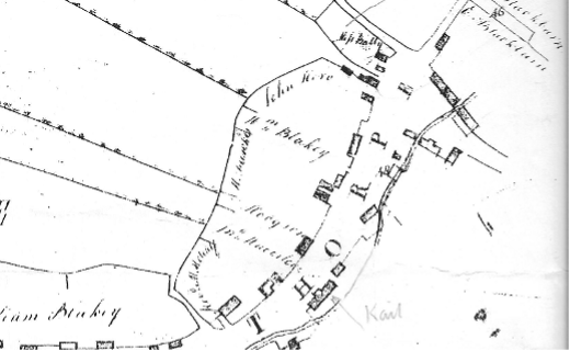
It was first documented in a plan drawn by the surveyor John Kirshaw in 1768.

Part of Kirshaw's 1768 plan of Thorpe, showing an open space in front of Mr Batty's house — now the Manor House — and a building called the Bull Laith. The small building to the left of the Manor House is now Manor House Cottage. Number 1 is Hardcastle House. Number 3 was later Appletree Cottage and is now a ruin.

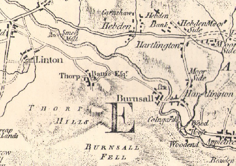
Jefferys' map of the district, 1771

Jefferys' map of the district, 1771.

The enclosure award, 1789

Part of the enclosure award map, 1789.

The maypole, 1804

For generations a prized maypole stood on the village green at Burnsall. In 1804 the cobblers of Thorpe, for a lark, stole it. Under cover of darkness a raiding party went over, uprooted the pole and planted it on the triangle.

When Burnsall woke to find it gone they searched Hartlington, Hebden and Appletreewick before discovering it re-erected at Thorpe. Not being in sufficient numbers to confront the cobblers, they enlisted help from neighbouring villages and returned, and after a sharp physical encounter carried the maypole home in triumph.

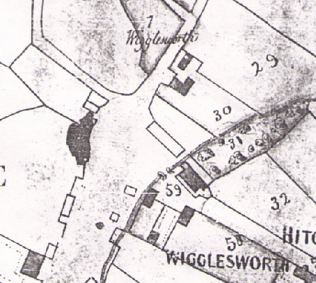
Rev Henry Wigglesworth, 1838

Rev Henry Wigglesworth of the Manor House, 1838.

The tithe map, 1848

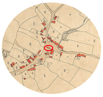
The open space at the centre of the village appears on several maps. One of the earliest is the tithe map of 1848, which shows it unenclosed, with the Bull Laith still standing to the west of the coach house and south of Manor House Cottage and Simon's Shippon.

The unenclosed land on the tithe map of 1848, with the Bull Laith to the west of the coach house. The red triangle is superimposed to show the approximate area.

The Plantation, 1853 to 1909

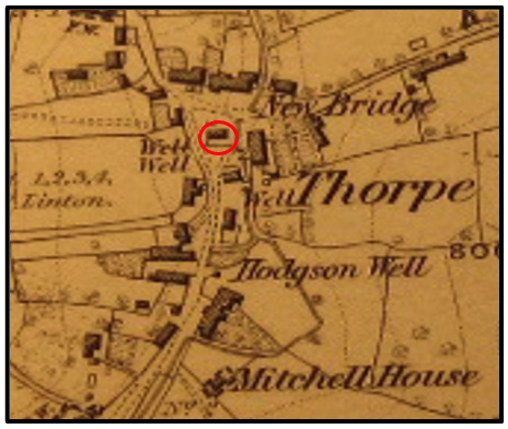
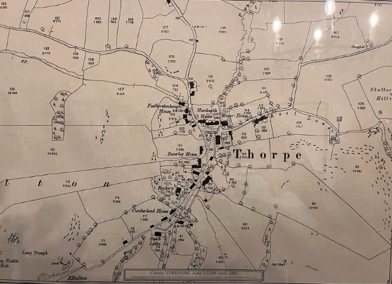
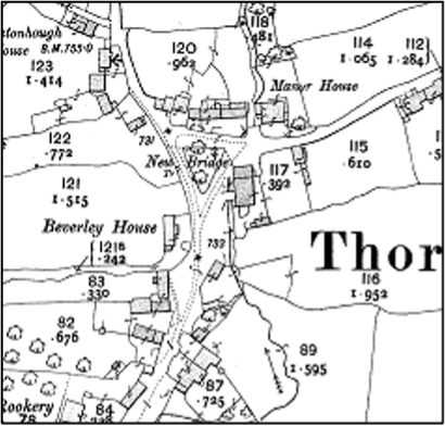
The Ordnance Survey maps of 1853 and 1891 both show the land without boundary walls. The 1853 map still shows a building where the Bull Laith had stood. By 1891 it has gone, and the map shows trees on the site — which is how the land came to be called the Plantation.

At that time most of the property and land in Thorpe belonged to the Procter family of Eshton. By 1909 the Plantation is shown with its trees and a wall around it.

The Ordnance Survey map of 1853. The land is bounded by a dotted line rather than the solid line that would mean a wall, and the Bull Laith is still standing.
The Ordnance Survey map of 1891, showing trees on the site and no building. This is the map that gives the land its middle name.
The Ordnance Survey map of 1909, showing the Plantation with trees and a wall around it.

Wesley Newton Rhodes, 1918 and 1920

In 1918 Wesley Newton Rhodes, a Bradford wool merchant, bought a large part of Thorpe from Nicholas Yeats of the Rookery for £3,550 — the Rookery, the stable barn, Rookery Cottage and 160 acres.

Two years later he bought almost all the rest of the village. The indenture is dated 14 December 1920 and was registered at the West Riding Registry of Deeds three days later. The vendor was Mary Procter of Eshton House, Gargrave, widow of Robert Procter of Croft House, Hetton, who had died in 1901; the land was sold by trustees appointed by order of the High Court that July. Rhodes paid £15,250, and the stamp duty was £152 10s.

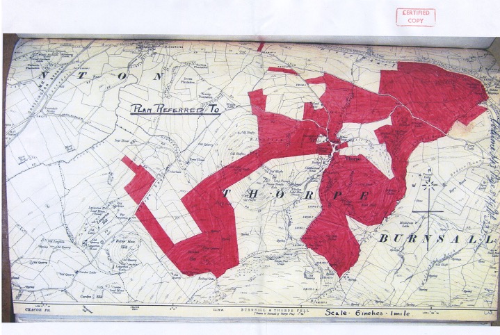
The deed covers the townships of Thorpe, Linton and Burnsall, and the land is shown on the attached plan coloured pink within a red boundary line.

The certified copy of the plan attached to the 1920 deed, showing in red the land bought by Wesley Newton Rhodes, between Linton, Thorpe and Burnsall.
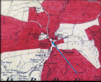
Part of the map attached to the deed of purchase by Wesley Newton Rhodes of the Procter estate in Thorpe, 1920, showing the triangle coloured red.
What the 1920 deed lists

Five parcels, in the words of the schedule, with the tenants of the day.

1. The dwellinghouse, farm buildings, yard and premises with 241.436 acres of meadow and pasture known as the Manor House Farm, then occupied by Hannah Foster and William Edward Foster.

2. The dwellinghouse, farm buildings, yard and premises with 147.407 acres of meadow and pasture known as Stott's Farm, then occupied by Simon Stott.

3. The close of meadow land containing 1.732 acres known as Kickay or Kicker Close, with the ley or parcel of ground at the bottom of it adjoining the River Wharfe, then occupied by Simon Stott.

4. The cottage with the garden or garth thereto, then occupied by Miss Saunders.

5. A dwellinghouse, farm buildings and 67.467 acres of meadow and pasture known as Hardcastle Farm, then occupied by Simon Stott.

The deed was signed by Mary Procter, witnessed by Robert Procter of Eshton House; by George Edward Turner, witnessed by a London solicitor; and by XXXXX Edward Wilson, witnessed by a clerk to Charlesworth and Wood, solicitors of Skipton.

Little Triangle, 1963

Rhodes had three daughters: Dorothy, Susie and Marjorie. He died in 1942, but his estate took a further twenty-one years to settle. Dorothy, who had married Fred Moulson Clayton, inherited most of the land west of Thorpe Beck including the Rookery. Susie, who had married her husband, took the houses and land mostly east of the beck, including the Manor House and Kail Farms.

The Deed of Partition of 19 August 1963 lists the land by Ordnance Survey number. Parcel 120, one tenth of an acre, is described simply as Little Triangle. It went to Dorothy Clayton, then to her husband Fred, and then to their daughter, who married into the family that holds it now.

The land is held today by trustees for the estate of the late F M Clayton.

Twelve trees, 1987

In 1987 Fred Clayton of Stable Barn, who was chair of the parish meeting from 1942 to 1989, arranged for twelve trees to be planted in the Plantation with money from the St John Ambulance Fund. There were thought to be twelve inhabited houses in the village at the time.

A year later seven of the trees were reported to have died. They were replaced, and most of them are still standing.

The first attempt, 1989

As a foretaste of things to come, a resident proposed to the 1989 parish meeting that the relatives of the late Fred Clayton be approached with a view to leasing the Plantation to the village for, say, ninety-nine years. It was agreed unanimously.

That was the first of three attempts to bring the triangle into public ownership. There is no record of the Clayton family's response, but when a dead lime had to be felled in 2018 the owner contributed towards the cost.

The maypole again, 1991

The rivalry stayed a footnote in local folklore until April 1991.

On 28 April, just before the May celebrations, Burnsall woke to find its 66 foot maypole gone. The pole had cost £150, raised by the community to replace one blown down in high winds, and had been cleaned and stripped for May Day and left lying on the ground.

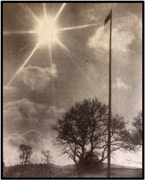
A mile and a half away, Thorpe woke to find a remarkably similar maypole concreted into the triangle and flying the Union flag. Villagers remained tight-lipped, and nobody admitted to seeing or hearing anything.

The chairman of Burnsall Parish Meeting told the press that it had not been entirely unexpected, that he had not thought they would actually put it up, and that it was taken in the spirit intended provided it came back. In Thorpe the chairman of the parish meeting said the village was growing rather fond of it, that he had seen nothing while seeing to sheep at about ten o'clock, that he had no idea how it got there, and that whoever had done it had put it up straight as a die and planted daffodils round the foot.

Three weeks later ten villagers from Burnsall arrived with ropes, ladders, spades and a tractor digger. A structural engineer climbed the pole and fixed a rope so it could be lowered safely. Four hours later it came down unharmed and went home with one end on a trolley and the other in the back of a Land Rover.

What had begun as a joke turned sour, with residents of both villages growing tired of tourists arriving to look for it.

The maypole standing on the triangle at Thorpe.
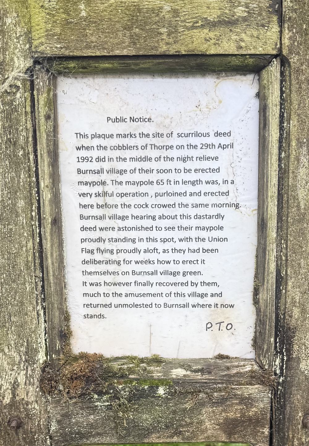
The notice on the triangle, front. It gives the date as 29 April 1992.
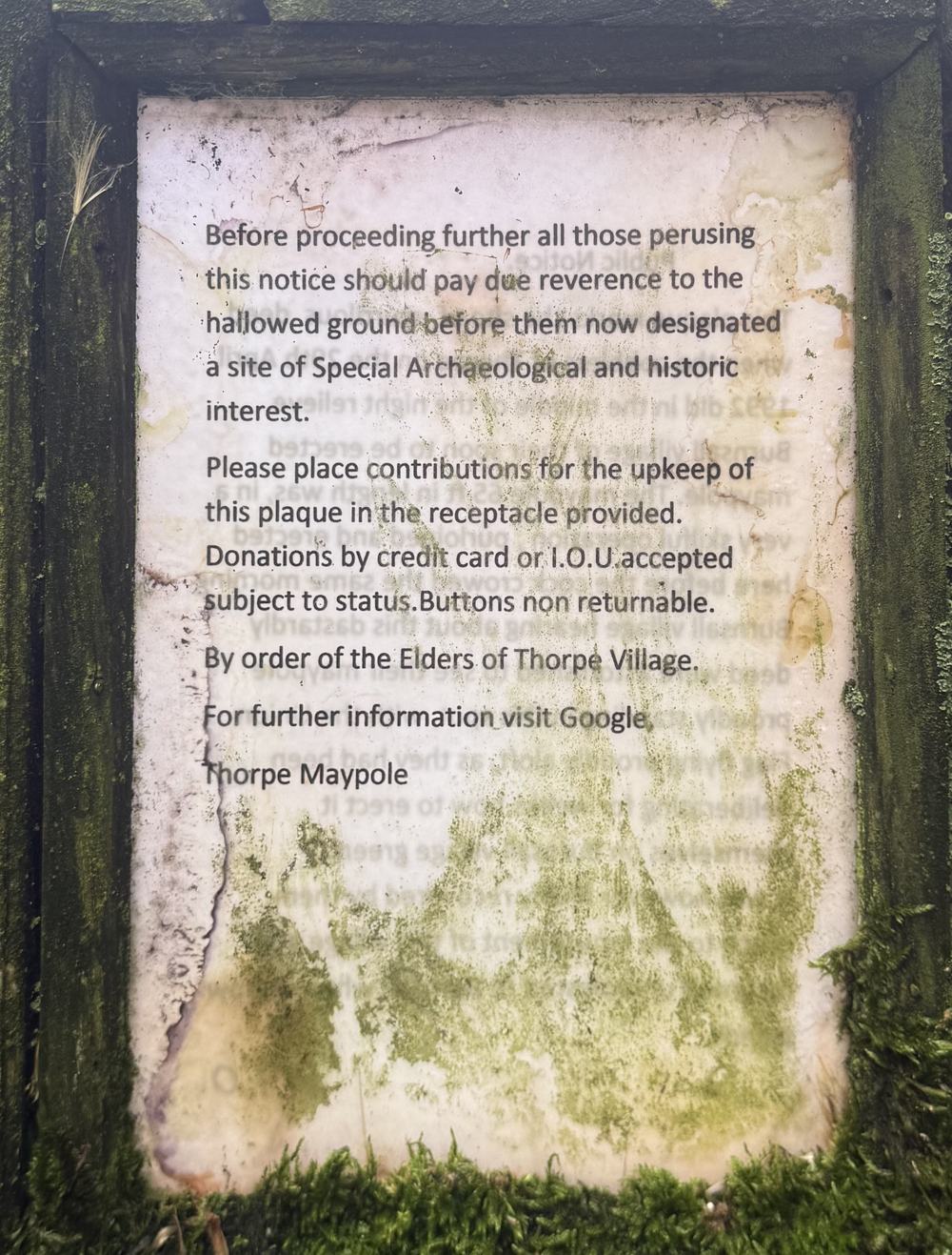
Turn it over, and the other side asks for contributions towards the upkeep of the plaque. By credit card or IOU, subject to status. Buttons non returnable.

Daffodils, clean-ups and a rota

The villagers went on looking after the land. In 1989 a resident planted daffodil bulbs in what was still called the Plantation.

Annual village clean-ups began in 1998, and a lawnmower was bought to cut the grass on the triangle and the verges around the village. A rota was organised by the chair of the parish meeting.

Celebrations

In more recent times the triangle has been the focal point for village celebrations, and a place for walkers and cyclists to rest.

The first of these in the twenty-first century was a St George's Day barbecue in April 2007, followed by barbecues each summer after it. In 2011 one was held in honour of the wedding of Prince William and Catherine Middleton, and the triangle was decorated with bunting made by two residents.

Most noteworthy was the Diamond Jubilee in 2012. A street barbecue on the triangle was followed by sports and children's games — egg throwing, horseshoe throwing and welly wanging. Seven children were presented with commemorative mugs by the chair of the parish meeting. The villagers then held a torchlight procession to the summit of Elbolton Hill, where a beacon was lit.

In 2015 the first of many village summer barbecues was held on the triangle.

The Thorpe Triangle Project, 2016

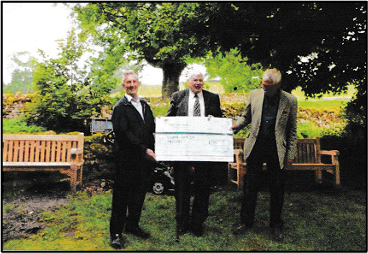
In 2016 the Thorpe Triangle Project, coordinated by a resident, raised over £2,000 to replace the ageing village mower and buy two new park benches for residents and visitors.

The principal donors were the Yorkshire Dales National Park Authority and Craven District Council. Residents, donors and friends celebrated the completion of the project on the triangle.

The Thorpe Triangle Project, 2016.

The second attempt, 2018

At the annual parish meeting in October 2018 a resident was asked to contact the family to see whether they would be prepared to pass the ownership of the land to the village. This second attempt met with no decision, though a contribution towards the tree felling was made.

In November 2018 the villagers again gathered on the triangle and formed a procession to the top of Elbolton Hill to light a beacon marking a hundred years since the end of the First World War. On returning, the torches were planted in the wall of the triangle and left to burn out.

Jubilee, coronation and carols

The barbecue held in September 2021 raised £222 for parish funds.

The Platinum Jubilee in June 2022 was marked by a village party, and commemorative mugs were presented to the children by the chair of the parish meeting.

The Coronation of King Charles III in 2023 was celebrated with a grand tea in a resident's barn, cleaned and decorated by the villagers for the occasion. Every child was given a commemorative fifty pence coin by a resident.

There is also carol singing at Christmas.

The Sue Ryder walk

The triangle is a refreshment stop on the annual Sue Ryder Wharfedale Pub Walk, a ten mile sponsored walk in aid of Manorlands Hospice. Villagers provide a barbecue and a cake stall.

It also lies on the walking route between Linton and Burnsall, and every rider on all three routes of the White Rose Classic passes it.

The third attempt, 2026

In 2026 a resident passed to the chair of the parish meeting, a letter from the family's agent saying that the land entrusted to the family was to be sold.

Andy called a meeting of the village, which agreed unanimously to buy the triangle. A meeting of the civil parish was held a few days later, and it was agreed to set up Thorpe Triangle Trust, a registered charity, to hold the land in perpetuity.

The third attempt to bring the triangle into the ownership of the community appears to be succeeding.

Nothing else in Thorpe is shared. There is no pub, no shop, no village hall and no church. The only other public amenity is a postbox.

The triangle as it is now.
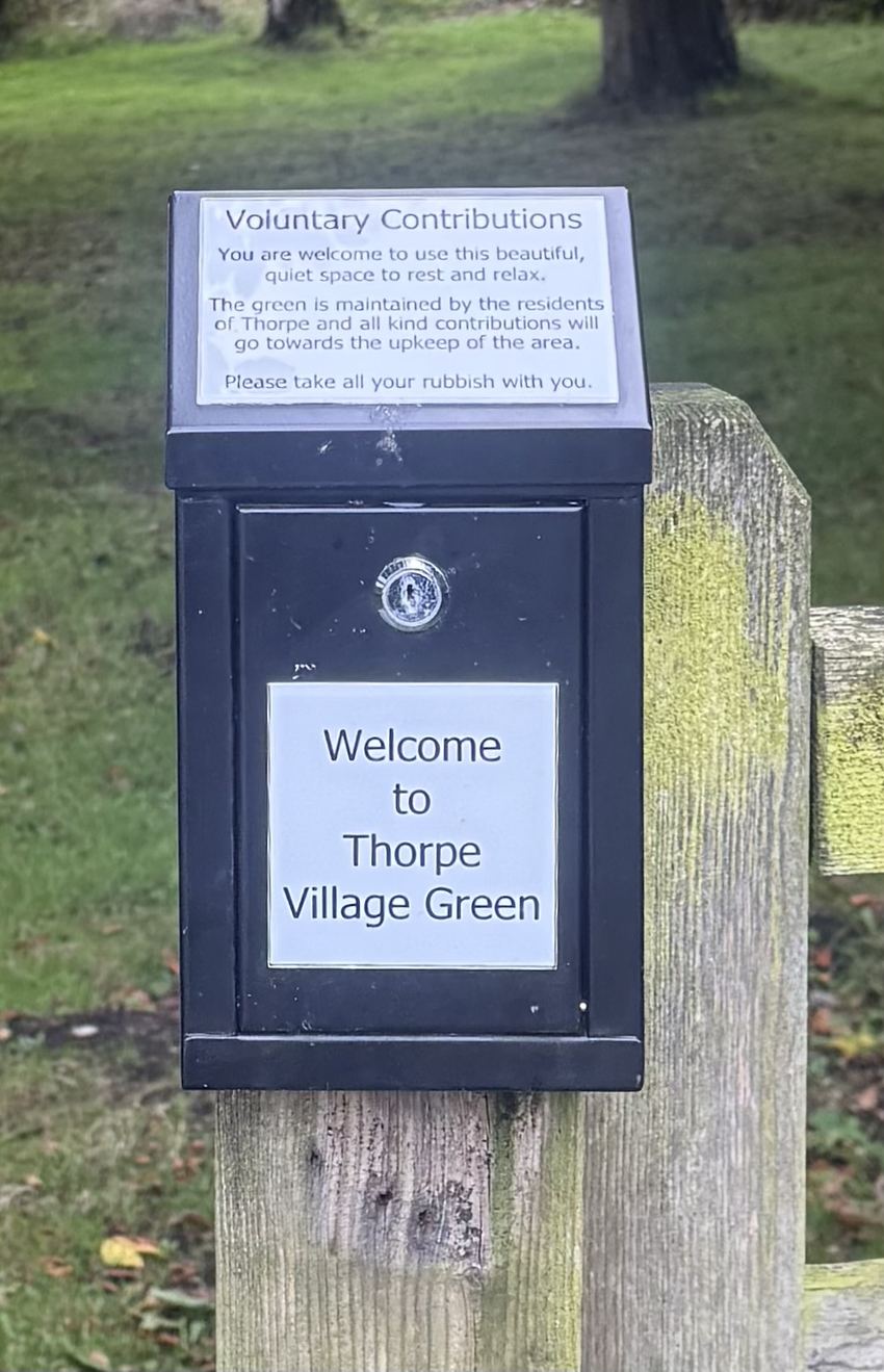
The box on the gatepost, for anyone who wants to leave something towards the upkeep.

Can you help us by funding any of the following?

Nobody is paid, and nothing goes anywhere else.

Card, Apple Pay and Google Pay. Gift Aid adds 25p to every pound if you pay UK tax.